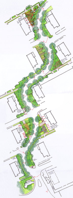
Chain of Parks Fujian, China
|
Catherine Oranchak/Landscape Architect with iPlace
Fujian, a mountainous province along the southeast coast of mainland China, provides the majestic setting for the Longyan Violet Paradise Sports Park project. The A-1 Housing Neighborhood is comprised of villa, duplex and multi-family residences that step up the mountainside. The residential buildings are oriented in a primarily east/west direction maximizing each unit's potential for sunlight within. The main access road winds its way uphill, creating open landscape spaces along its curving profile- referred to as the Chain of Parks. Over a dozen small urban parks of approximately 3 hectares in size provide public open space to visitors and residents alike. Each park is meant to reflect the character of its adjacent neighborhood; providing places to sit, read, reflect and play. Pedestrian access is possible by way of stepped and sloped access points adjacent to the nearest residential building's private outdoor space. The richness of the spaces is expressed in a wide variety of varying shapes and spaces. A temporary park was developed as a transitional entry from the adjacent Urban Center to the Model Homes, complete 2014 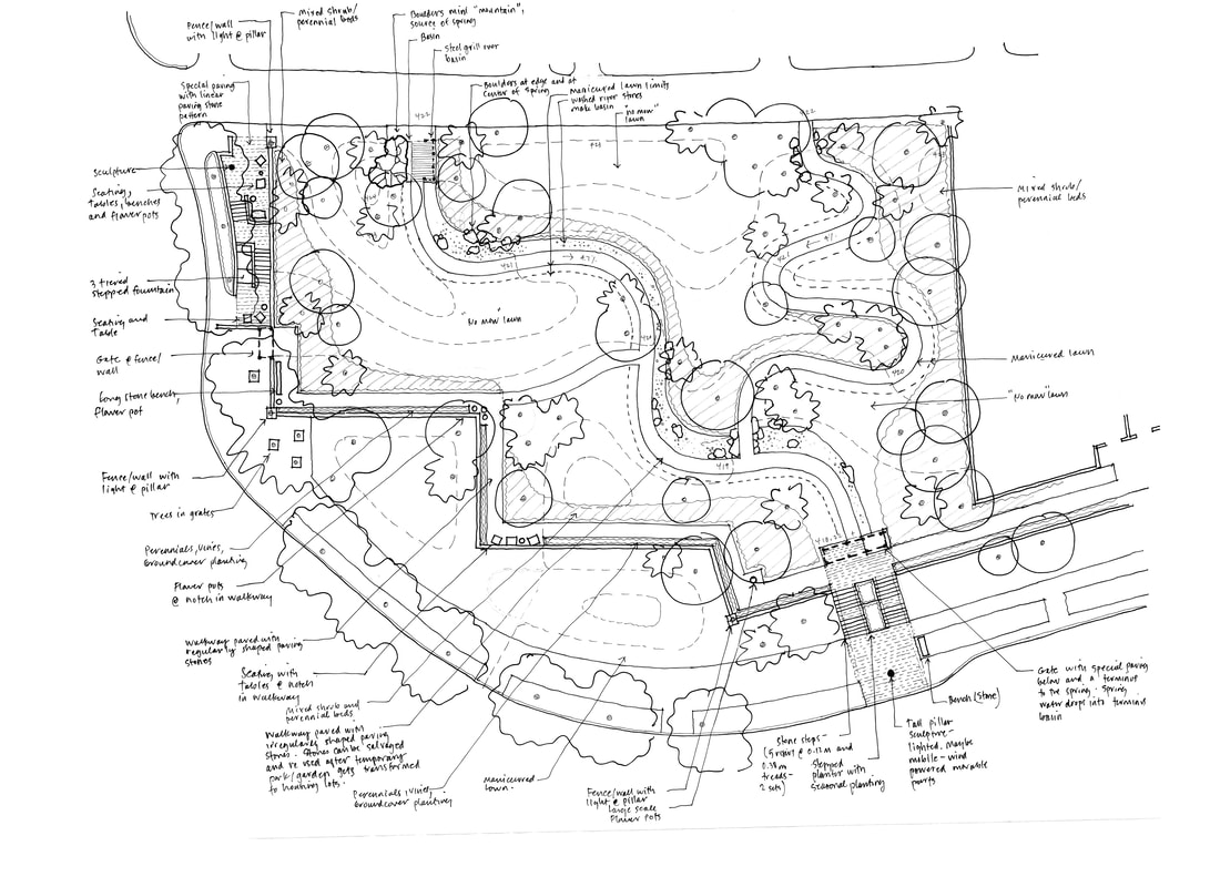
|
Smale Riverfront Park Cincinnati, Ohio
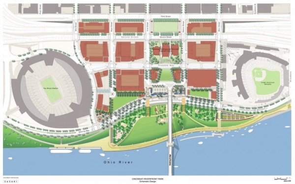
Smale Riverfront Park Master Plan
With Sasaki Associates for the US Army Corps of Engineers and the Cincinnati Park Board
The proposed thirty-one acre park sits prominently on the banks of the Ohio River within downtown Cincinnati. It is bisected by the historic Roebling Bridge; flanked by the Paul Brown Stadium to the west and the Great American Ballpark to the east. The park design springs from the existing street grid pattern and reconnects the city to its waterfront.
Awards:
2013 National Recreation and Park Association, Park Design Award
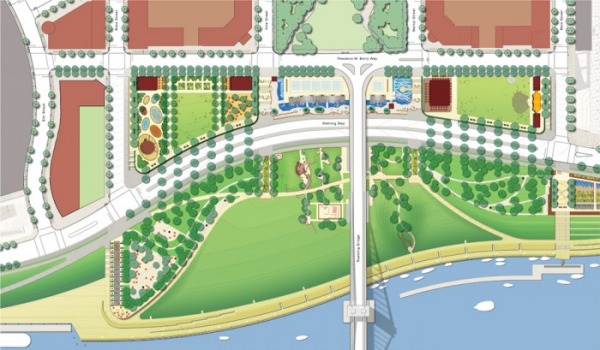
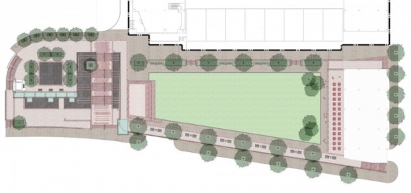
Urban Park to the north, Pastoral Park to the south
The Park is comprised of two distinct districts: to the north the urban park features dramatic water fountains, restaurants and cafes, performance areas and garden spaces. To the south, the pastoral park setting allows for strolling walkways passing public art installations, children's play areas, historic remnants/artifacts while encouraging public access at the river's edge. The design accommodates annual flooding by way of grading and material selection.
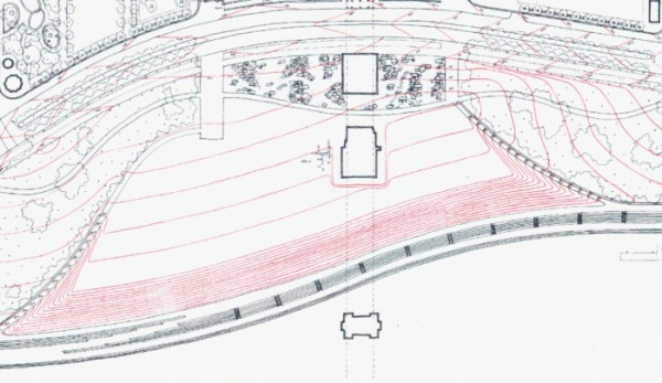
Grading Study
Grading strategy keeps large portions of the park out of the five year flood.
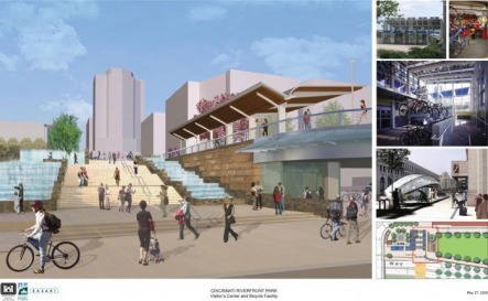
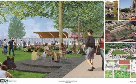
Walnut Street Fountain and Grand Stairway (left), Event Lawn (right) Design Development
Walnut Street Fountain and Grand Stairway (left)
The landing of the Roebling Bridge from Kentucky to Ohio is commemorated with a programmable interactive water feature and lighted stainless steel trellis structure. Glass paved overlooks spill water into basins below. The historic connection between Walnut Street and the Ohio River is recreated with the proposal of a grand granite-clad stairway edged with cascading water stairs.
Walnut Street Event Lawn (right)
The raised granite platform and canopy face a flexible open lawn. A restaurant with outdoor dining sits at the corner of Main Street and Mehring Way.
 Walnut Street Grand Stairway with Water Cascades |
 Walnut Street Event Lawn: Canopy and Open Lawn |
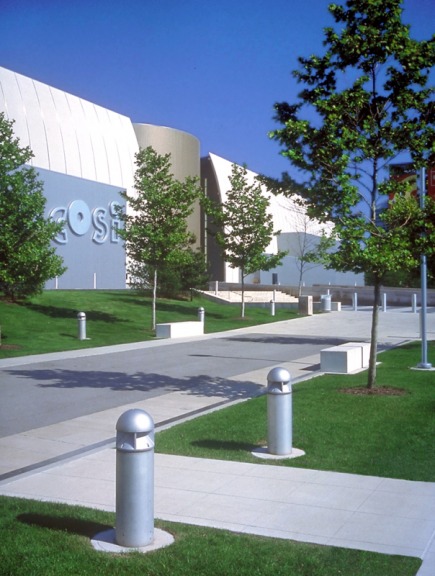
COSI (Center of Science and Industry) Columbus, Ohio
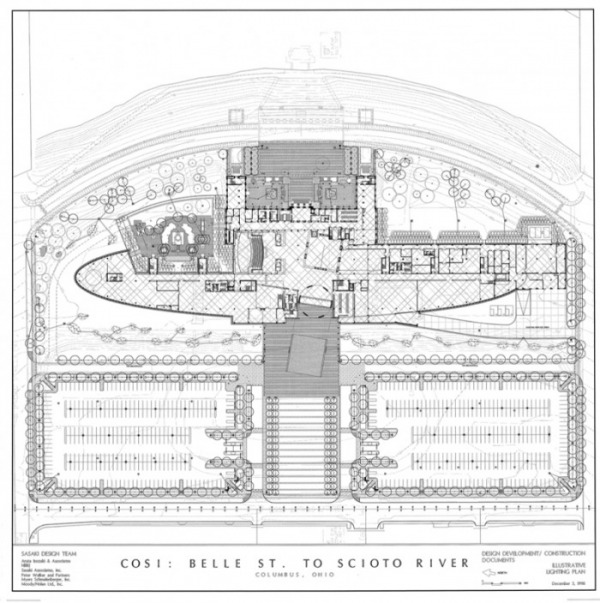
Site Plan
With Sasaki Associates for the Ohio Arts & Sports Facilities Corporation
The architect, Arata Isozaki, transformed the existing urban high school into the relocated home of Columbus' Center of Science and Industry (COSI). The east facade addresses downtown Columbus while the west facade addresses the "frontier"- an area of future expansion for the City. The COSI site and its neighboring public waterfront park were the first implementation phase of the nine-mile riverfront vision plan. This riverfront destination is a jewel along a necklace of public open space uses following continuous paths and walkways along the Scioto River.
The architect, Arata Isozaki, transformed the existing urban high school into the relocated home of Columbus' Center of Science and Industry (COSI). The east facade addresses downtown Columbus while the west facade addresses the "frontier"- an area of future expansion for the City. The COSI site and its neighboring public waterfront park were the first implementation phase of the nine-mile riverfront vision plan. This riverfront destination is a jewel along a necklace of public open space uses following continuous paths and walkways along the Scioto River.
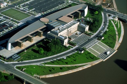 High School with addition at west (left) |
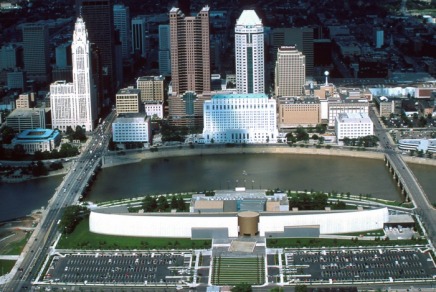 Looking east toward downtown Columbus |
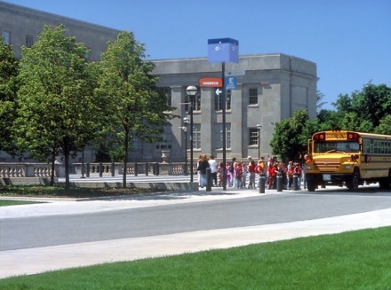 East drop off plaza |
 West Plaza/Entry |